














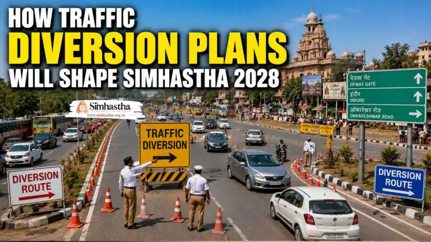
How Traffic Diversion Plans Will Shape Simhastha 2028
Discover how traffic diversion plans will shape Simhastha 2028 with Google Maps systems, 400 police personnel, 3,000-acre parking, and three-tier holding areas.

The 40 Crore Vehicle Challenge 🚗🌊
Let me paint you a picture. 🎨
Imagine 40 crore devotees arriving in a city designed for a fraction of that number. Now imagine all of their vehicles—cars, buses, trucks, two-wheelers—trying to navigate the same roads. The result? A traffic nightmare of epic proportions. 😱
But here's the good news: the planners of Simhastha 2028 have anticipated this. They've designed a traffic diversion masterplan that rivals the complexity of any major global event. 🌍
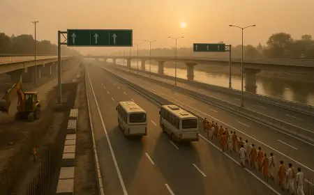
So, how will traffic diversion plans shape Simhastha 2028? The answer involves a modified Google Maps system, 400 police personnel across 8 zones, 3,000 hectares of parking, a three-tier holding system, and unprecedented use of technology to guide millions of vehicles. 🚀
Trending Guides Now
How Ujjain’s New Parking Hubs Will Handle Millions During Simhastha 2028
How Ujjain's Transport Network Is Changing Before 2028
New Public Toilets and Sanitation Projects for Simhastha
Ujjain's New Riverfront Plans Before Simhastha 2028
Ujjain Railway Station to Mahakaleshwar Temple Distance (2026 Guide)

Ujjain Simhastha 2028 Dates Announced: Full Shahi Snan & Event Timeline
Ujjain Railway Station to Mangalnath Temple: Distance, Auto Fare and Best Route
Mahakaleshwar to Kal Bhairav Temple: Distance, Auto Fare, Travel Time and Route Options
In this article, we'll explore every layer of the traffic management strategy—from the moment you enter Madhya Pradesh to the moment you park and walk to your tent city. 🏗️
The Scale of the Challenge: 6,000 to 12,000 Vehicles Daily 📊🚗
Normal Days vs Festival Peak
The sheer volume of vehicles is staggering. 📈
On Normal Days:
-
🚗 Daily Vehicles: Nearly 6,000 four-wheelers enter Ujjain
-
🚦 Traffic Flow: Manageable, with standard city congestion
-
🅿️ Parking: Available within city limits
During Simhastha 2028:
-
🚗 Daily Vehicles: Expected to double to around 12,000 vehicles daily
-
🚦 Traffic Flow: Severe congestion without planning
-
🅿️ Parking: 3,000 hectares of designated parking areas
The Peak Problem:
During Shahi Snan days, the number of vehicles could surge even higher. The Google Maps traffic management system, piloted in December 2025, demonstrated its effectiveness—and will be crucial for Simhastha.
The Three-Tier Holding System: Controlling the Flow 🏕️📍
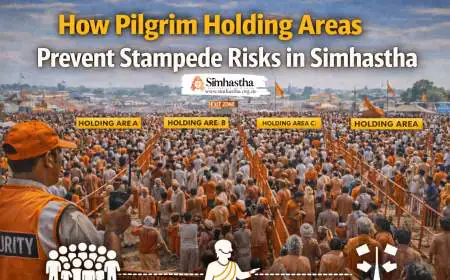
Tier 1: Holding Hubs in 10+ Districts
Before vehicles even reach Ujjain, they'll be managed through a three-tier holding system. 📍
The Holding Hubs:
| District | Role |
|---|---|
| Indore | Primary holding hub |
| Khandwa | Secondary holding hub |
| Sehore | Transit hub |
| Bhopal | Backup holding hub |
| Narmadapuram | Transit hub |
| Jhabua | Regional hub |
| Ratlam | Western entry hub |
| Agar Malwa | Regional hub |
| Shajapur | Eastern entry hub |
| Neemuch | Northern entry hub |
| Mandsaur | Northwestern entry hub |
What These Hubs Offer:
-
🅿️ Parking Facilities: Dedicated vehicle parking

-
🍛 Food Courts: Meals and refreshments
-
🚻 Rest Zones: Bathrooms and resting areas
-
🏥 Medical Units: Emergency healthcare
-
🚰 Drinking Water: Safe water stations
-
🚿 Bathing Facilities: For pilgrims
-
⛽ Fuel Stations: Vehicle refueling
-
🚽 Bio-Toilets: Sanitation facilities
-
📋 Helpdesks: Information and guidance
-
📢 Public Address: Announcements and updates

Tier 2: Satellite Parking
Once pilgrims pass through the holding hubs, they reach satellite parking areas around Ujjain.
Key Features:

-
🅿️ Designated Zones: 30 sectors across 3,000 hectares
-
🚌 Shuttle Services: Transport from parking to tent cities
-
🚶♂️ Walking Routes: Clear pathways to the mela area
-
📱 Real-Time Updates: Parking availability via app
Tier 3: Phased Entry into Ujjain
Based on real-time crowd data, vehicles are released into Ujjain in phases.
The Flow:
-
📊 Crowd Monitoring: AI system tracks crowd density
-
📋 Release Decision: Vehicles held or released based on capacity
-
🚗 Direct Navigation: Google Maps guides drivers to designated parking
-
🚌 Shuttle Transfer: Pilgrims taken to tent cities
The Google Maps Traffic Management System 🗺️📱
How It Works
The most innovative traffic diversion tool is the modified Google Maps system. 💻
The Team:
-
👨💻 10-Member Team: Police personnel, cyber team, and IT company experts
-
⏰ Hours: 8 AM to 10 PM daily monitoring
-
🗺️ Algorithm: Modified Google routing algorithm
The Process:
-
📊 Traffic Monitoring: Real-time traffic data is collected
-
🚧 Congestion Identification: Congested roads are identified
-
🗺️ Route Blocking: Congested routes are removed from Google Maps
-
🚗 Alternative Routing: Less crowded routes are activated
-
📱 Real-Time Updates: Constantly monitored and adjusted
Why This Is Revolutionary:
Devotees traveling from outside cities do not see congested inner-city routes on their navigation apps. They are guided directly to designated parking areas through outer roads, bypassing the chaos. 🚦
The Impact on Pilgrims
For the Pilgrim:
-
✅ No Traffic Anxiety: Automatic rerouting avoids congestion
-
✅ Reaching Designated Parking: Directed to available parking
-
✅ Saving Time: Bypasses traffic jams
-
✅ Stress-Free Journey: Peaceful arrival experience
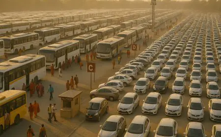
The Parking Masterplan: 3,000 Hectares Across 30 Sectors 🅿️🏞️
The Scale of Parking
3,000 hectares of parking—that's the size of roughly 4,200 football fields! 🏟️
The Breakdown:
-
🅿️ 30 Sectors: Organized into 30 designated zones
-
🚗 Capacity: Tens of thousands of vehicles
-
📍 Locations: Throughout Ujjain and neighbouring districts
-
🔄 Integration: Connected to the three-tier holding system
Parking Sector Allocation
Vehicles are directed to specific sectors based on:
-
📍 Origin: Where the pilgrim is coming from
-
🏕️ Destination: Which tent city they're heading to
-
🕐 Arrival Time: To balance sector loads
-
🔄 Availability: Real-time parking availability
What Happens After You Park
-
🚌 Shuttle Buses: Take you to your tent city
-
🚶♂️ Walking Routes: Designated walking paths
-
📱 App Guidance: Step-by-step navigation from parking to tent
The Police Deployment: 400 Personnel Across 8 Zones 👮🚓
The Traffic Management Team
The Ujjain police administration is acutely aware of the traffic challenges. 🚓
The Numbers:
-
👮 Total Personnel: Nearly 400 police personnel
-
🚓 Additional Allotment: Around 250 additional personnel for Simhastha
-
🏛️ Existing Officers: Nearly 150 officers already stationed in Ujjain
-
📍 8 Zones: The city is divided into 8 zones for coverage
Zone-Wise Deployment
| Zone | Coverage Area |
|---|---|
| Zone 1 | Mahakaleshwar Temple approach |
| Zone 2 | Kal Bhairav Temple area |
| Zone 3 | Shipra River ghats |
| Zone 4 | Railway station and bus stand |
| Zone 5 | Tent city sectors |
| Zone 6 | Parking sectors |
| Zone 7 | Holding hub approaches |
| Zone 8 | City center and markets |
Why the Urgency?
Since the development of the Mahakal Lok Corridor, the number of devotees visiting Ujjain has risen sharply, posing a significant challenge for traffic management. The 2028 plan builds on lessons learned from the Google Maps pilot and the 2016 Simhastha. 📈
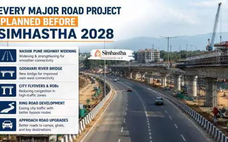
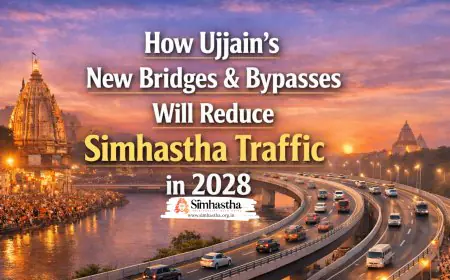
The Road Infrastructure: New Routes, Flyovers, and Bridges 🛣️🌉
Major Road Projects
The traffic diversion plans are supported by massive road infrastructure projects:
| Project | Cost | Key Features |
|---|---|---|
| Ujjain-Jaora Greenfield Corridor | ₹5,017 crore | 7 flyovers, 3 rail overbridges |
| Ujjain-Indore Six-Lane Highway | ₹1,692 crore | Wider capacity |
| Indore-Ujjain Greenfield Corridor | ₹2,935 crore | 4-lane highway |
| 22 New Bridges | Various | Improved river crossings |
| 5 Railway Over-Bridges | Various | Reduced rail crossing delays |
| 17 River Bridges | Various | Enhanced connectivity |
The Ujjain-Jaora Corridor
The Ujjain-Jaora Greenfield Four-Lane Corridor is the crown jewel:
-
📏 98.73 km long
-
🌉 7 flyovers
-
🚆 3 rail overbridges
-
🌊 8 major bridges
-
🏗️ 22 medium bridges
-
🚧 36 underpasses
-
🌐 2 overpasses
-
🧱 430 culverts
Target Completion: December 2027
Economic Impact: Will benefit around 3.5 million people and connect 50 villages in Ujjain district and 12 villages in Ratlam district.
The Green Corridor: Emergency Vehicle Priority 🚑🚨
For Emergencies Only
The traffic diversion system includes dedicated Green Corridors for emergency vehicles. 🟢
Green Corridor Features:
-
🚑 Priority Lanes: Reserved for ambulances and emergency services
-
🚔 Police Escort: Quick movement through traffic
-
🛑 Traffic Control: Signals adjusted for priority vehicles
-
🏥 Medicity Connection: Quick access to the 550-bed Medicity
What This Means for You:
If there's a medical emergency, help gets to you fast. The Green Corridor bypasses traffic jams.
The Public Transport Alternative 🚌🚂
Encouraging Shared Transport
To reduce private vehicle pressure, the government is promoting public transport:
-
🚌 Special Buses: Additional buses from Indore and nearby cities
-
🚂 Train Services: Increased frequency on the Indore-Ujjain route
-
🛺 Auto-Rickshaws: More availability and designated stands
-
📱 App-Based Taxis: Ola and other services will be available
The Indore-Ujjain Rail Corridor
-
🚆 Quadrupling: The Indore-Ujjain railway section is being quadrupled
-
🚆 New Trains: Several new express trains are being introduced
-
🚉 Station Upgrades: Better amenities at Ujjain Junction
The Simhastha 2028 Traffic Flow: Step by Step 🗺️🚗
Step 1: Before You Enter Madhya Pradesh
-
📍 Interstate Checking: Security and screening at state borders
-
🗺️ Navigation: Google Maps already guiding you
-
📱 App Updates: Real-time traffic and parking info
Step 2: Entering the Holding Hub
-
📍 Your District Hub: Based on your origin
-
🅿️ Park: At the designated holding hub
-
🚻 Rest: Use facilities while you wait
-
📱 Check: App tells you when it's your turn
Step 3: Release to Satellite Parking
-
🚗 Drive: Released in phases
-
🗺️ Google Maps: Guided to specific parking sector
-
🅿️ Park: At your designated sector
Step 4: Shuttle to Tent City
-
🚌 Shuttle Bus: Takes you to your tent city
-
🚶♂️ Walk: To your tent
-
🏕️ Check-In: Tent city check-in process
Step 5: Moving Around During the Mela
-
🚌 Shuttles: Regular shuttle service
-
🛺 Auto-Rickshaws: Available for short trips
-
🚶♂️ Walking: The tent city is designed for walking
-
📱 App: Real-time crowd and traffic guidance
The Bottom Line: A System Designed to Move Millions 🎯
So, how will traffic diversion plans shape Simhastha 2028? Through a remarkable combination of:
-
Three-Tier Holding System: Managing flow before you arrive 📍
-
Google Maps Integration: Guiding you to available parking 🗺️
-
3,000 Hectare Parking: Space for millions of vehicles 🅿️
-
400 Police Personnel: Managing 8 traffic zones 👮
-
New Infrastructure: Roads, flyovers, and bridges 🛣️
-
Green Corridors: Emergency priority routes 🟢
-
Public Transport: Reducing private vehicle pressure 🚌
-
Real-Time Apps: Keeping you informed 📱
The message is clear: You will not get stuck in Ujjain. The traffic diversion system is designed to keep you moving, keep you safe, and keep your experience focused on the spiritual, not the stressful. 🕉️
Frequently Asked Questions